Somerton is small, quiet and easy to explore on foot. In an hour or two you can walk past a Norman church, the earthworks of a medieval castle and its fishponds, the last wall of a Tudor manor house, a canal wharf, a lock nearly twelve feet deep and a pair of wartime pillboxes, with a view back across the whole valley if you have the energy for one more climb.
Before you set off. People live here, and much of what you will pass is private. Please keep to the public footpaths, close gates behind you, keep dogs on leads near livestock, and enjoy the private houses mentioned here from the path or the road only.
Parking. Park considerately along Church Street, or down by the canal bridge on the road to North Aston.
What to wear. The field paths and the towpath can be muddy for much of the year, so boots are a good idea.
The trail map
The numbers match the stops below. Brown stops are in the village, blue stops are down by the canal and river, and green stops are further afield. Pins are approximate.
Map data © OpenStreetMap contributors.
The village trail
This walk goes from the church, down through Castle Yard to the canal and the river, about an hour there and back, or longer if you walk the towpath to the deep lock. You can just as easily do it in reverse from the canal, where there is also parking.
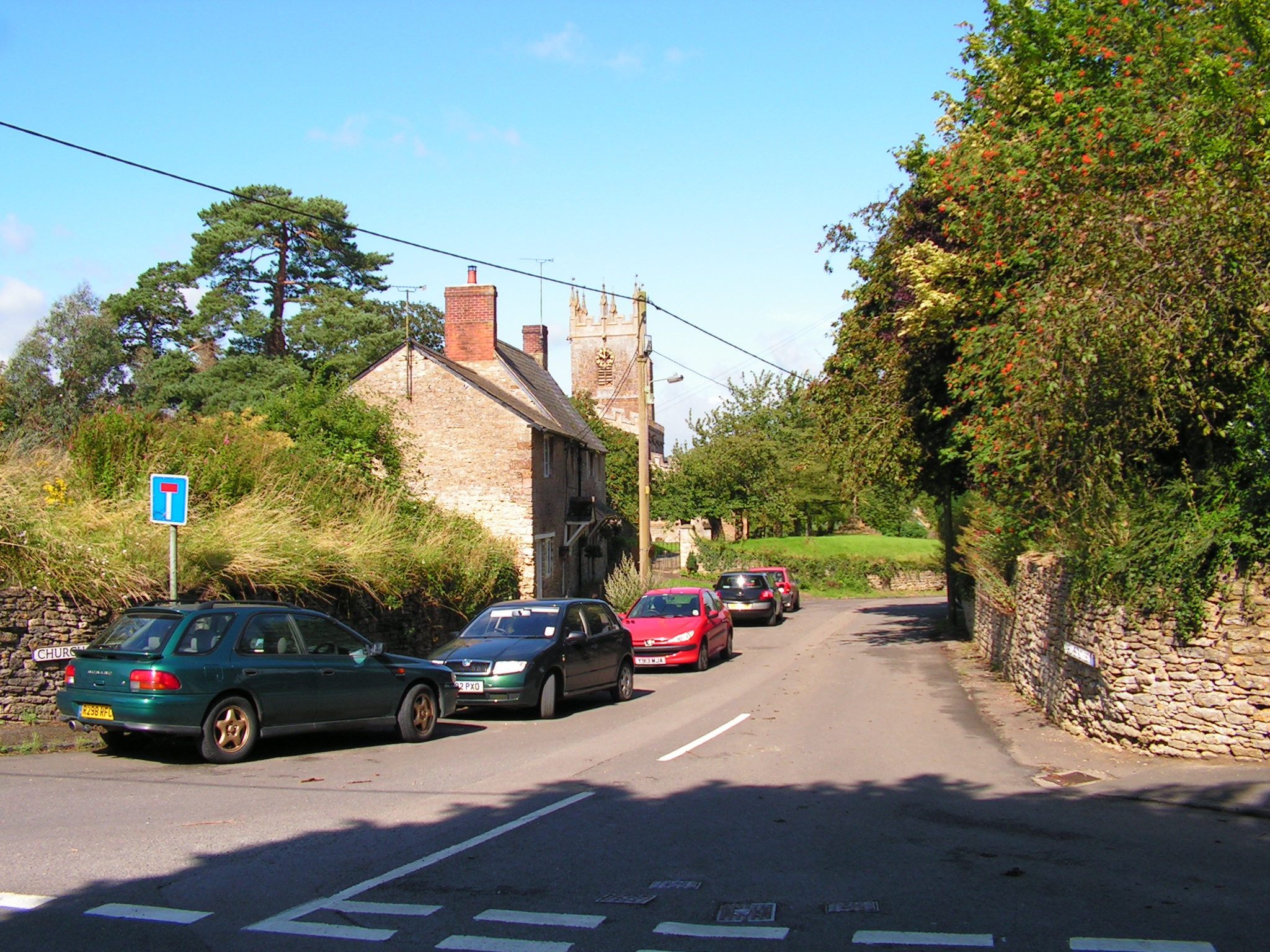
St James's church and the churchyard cross
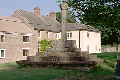
The church has stood here since soon after the Norman Conquest. The blocked Norman doorway in the south wall is the oldest part to survive, and the round Norman pillars inside are not much younger. If the church is open, look for the Fermor chapel, with its family monuments, and the Whall window. On the north side of the churchyard stands the old preaching cross, clearly medieval, though nobody knows exactly how old.
Down Church Street to a later village school
Walk down Church Street, away from the main road. Near the bottom is a cottage, thatched until the 1970s, where Miss Jennings and her sister once ran a small school in part of the house. It is a private home, so please look from the street.
Through the kissing gate: the fishpond field
At the bottom of Church Street a kissing gate takes you onto a public footpath running downhill across the field. It is a right of way all the way, but please keep to the path itself. This field was once a busy corner of the medieval village, and the bumps and hollows are the remains of its lanes and house plots.
Up on your right, as you go down, are the old coach house and then the imposing Old Rectory. Rumour has it that a lady in grey stands looking out of the top window.
Near the bottom of the field the path passes between two of the castle's fishponds, their banks still visible on either side. The archaeologist R. A. Chambers found in 1973 that the path runs along the causeway dug to separate them. They were probably the fishponds listed in a survey of the manor in 1295.
Archaeology, including an artist's impression of this view as it may have looked around 1300
Castle Yard and the Old School House
Through a second kissing gate you are in Castle Yard. There was never a great stone keep here: Somerton's "castle" was more a defended manor house, a walled yard with a hall, a dovecote and a chapel. In 1580 Thomas Fermor left the chapel to become the village school, and the Old School House, on your right, is said to stand on the spot. Burials found here in 1953 and 1969 show this was once a cemetery. On your left is a sunken garden with a pond and a stream. Both are private, so enjoy them from the path, which brings you out on Water Street beside what was once the Railway Inn.
Down to the canal and the river
From Water Street, follow the road out of the village towards North Aston.
The railway bridge and the old station
The road passes under the railway. Just before the bridge, look up to your left: that is where Somerton's station stood. The line opened in 1850 and the station in 1854, a simple wooden building, renamed Fritwell & Somerton in 1907. The last train called in 1964.
The old wharf and the canal bridge
On your left after the railway bridge is the site of Somerton Wharf, now houses and cottages. The Oxford Canal opened past Somerton in 1787, and for sixty years, before the railway came, it was the village's road to the wider world. When the estate was sold in 1919 the wharf and Wharf House went with the Railway Inn. The road then climbs over the canal on a humpbacked bridge.
Economic life, including an artist's impression of the wharf around 1840
Wartime pillboxes
Just over the canal bridge, in the fields right beside the road, is a concrete pillbox on either side. Thousands like them were built across England in 1940, when a German invasion was expected, to guard river, canal and road crossings. Each held a few soldiers with rifles or a machine gun, firing through the narrow slits. They were never needed, and they have stood quietly in the meadows ever since.
The towpath to Somerton Deep Lock and Lock Cottage
As you cross the canal, the towpath leads off to the right, heading north with the water meadows on your left. After about two-thirds of a mile you reach Somerton Deep Lock, Lock 34. With a rise of about twelve feet it is one of the deepest on any canal in England, a single-gate design chosen when the canal company ran short of money. Beside it stands Lock Cottage, which can only be reached along the canal. Lock, bridge and cottage are all listed, and the cottage is a private home. If you have the legs for it, the towpath carries on north to Aynho Wharf, about two and a half miles from the village bridge, and on to Banbury.
The river bridge and North Aston Mill
Back on the road, a second bridge, this one of iron, crosses the River Cherwell. Right beside it, sitting on the river, is the old mill, a former watermill of the 1600s or early 1700s, built of limestone with stone-slate and thatched roofs. Its long mill range is built straight across two channels of the millstream. The river is the parish boundary here, so although it looks like part of Somerton, the mill officially belongs to North Aston. It is now a house, listed as North Aston Millhouse, and much of the old mill machinery is said to survive inside. It is a private home, so please look from the road. The road then climbs up the far side of the valley towards North Aston.
Along the Heyford Road
Three more stops on the other side of the village, south of the church.
The Fermor arch and the site of the manor house
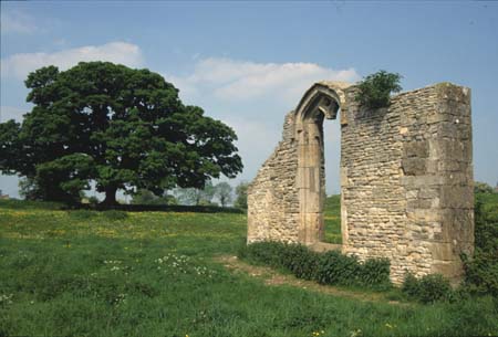
In the field to the east of the Heyford Road a footpath passes the last standing piece of the Fermor family's Tudor manor house: the west wall of the hall with its great window. Look across the field and you can still make out the square, sunken outline where the house stood. The Fermor family held Somerton for three centuries and kept the Catholic faith alive here.
The Fermor family, including an artist's impression of the manor around 1580
The back path to Church Street
From beside Jersey Manor Farm on the Heyford Road, a footpath runs behind the Barnes Memorial Hall and the Heyford Road houses, past the newer part of the churchyard, and brings you out on Church Street.
Down to Somerton Mill
Head south out of the village along the Heyford Road, past Jersey Manor Farm on your right and Aston View on your left. A lane then leads off to the right, all the way down the hill and across the railway, to Somerton Mill: Mill Cottage, a cluster of old mill buildings and another small cottage, sitting right on the river. It is one of the most picturesque corners of the parish. The railway crossing here had a keeper living in a cottage provided by the Great Western Railway, and in January 1850 Charles Godwin, mealman of Somerton Mill, was found drowned in a canal lock after walking home from Bicester market in the dark. The lane is open to walkers, but the houses are private homes, so please be considerate.
Further afield
The view from Middle Aston
For the best view of Somerton, go up to Middle Aston on the other side of the valley. Right by Middle Aston House there is a viewpoint looking straight back across the Cherwell valley to Somerton, with the church tower, the village on its ridge, the canal, the railway and the river laid out below.
Heyford Park: the Cold War airbase
From the top of Aston View a footpath leads to what was RAF Upper Heyford, home to the United States Air Force during the Cold War. It is now a village in its own right, Heyford Park, but the hardened aircraft shelters, the runway and many of the base buildings are still there, and the flying field is a protected conservation area. Tours of the historic base have been run, so check what is on before you go. Americans from the base were part of Somerton life for decades.